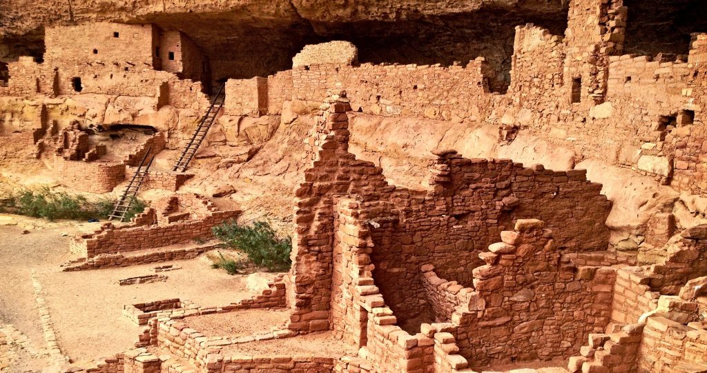
Can You Dig It? Looking Back by Looking Down at What is Hidden in Plain Sight – The Exciting Role of Drones in Archeological Research!
The world of archeological science has always been bedevilled by a unique problem – how do we find the hard-to-find?
It should come as no surprise, then, that sopsthicated new visual, mapping, 3D, infrared and other drone technologies are coming to provide fascinating new opportunities to overcome this dilemmna.
In effect, drones have become the new high-tech measuring tape for the world of archeology!

Over at the Smithsonian, they reported on what is the world’s largest 3D maps of an archeoglical site – two unique Scottish islands:
Last November, the conservation charity National Trust for Scotland, which administers the islands, hired the Glasgow-based mapping firm GeoGeo to conduct a detailed drone survey of the islands to precisely locate archaeological features. Over the course of five days, a state-of-the-art fixed wing drone flew a total of about 250 miles, collecting 4,000 ultra-high-resolution images and 420 million data points. The team then used a proprietary super computer to analyze the data, creating an incredibly detailed 3-D map of the connected islands.
Talk about opportunity! Think about the vast role that drones are playing within the archeological world!
●
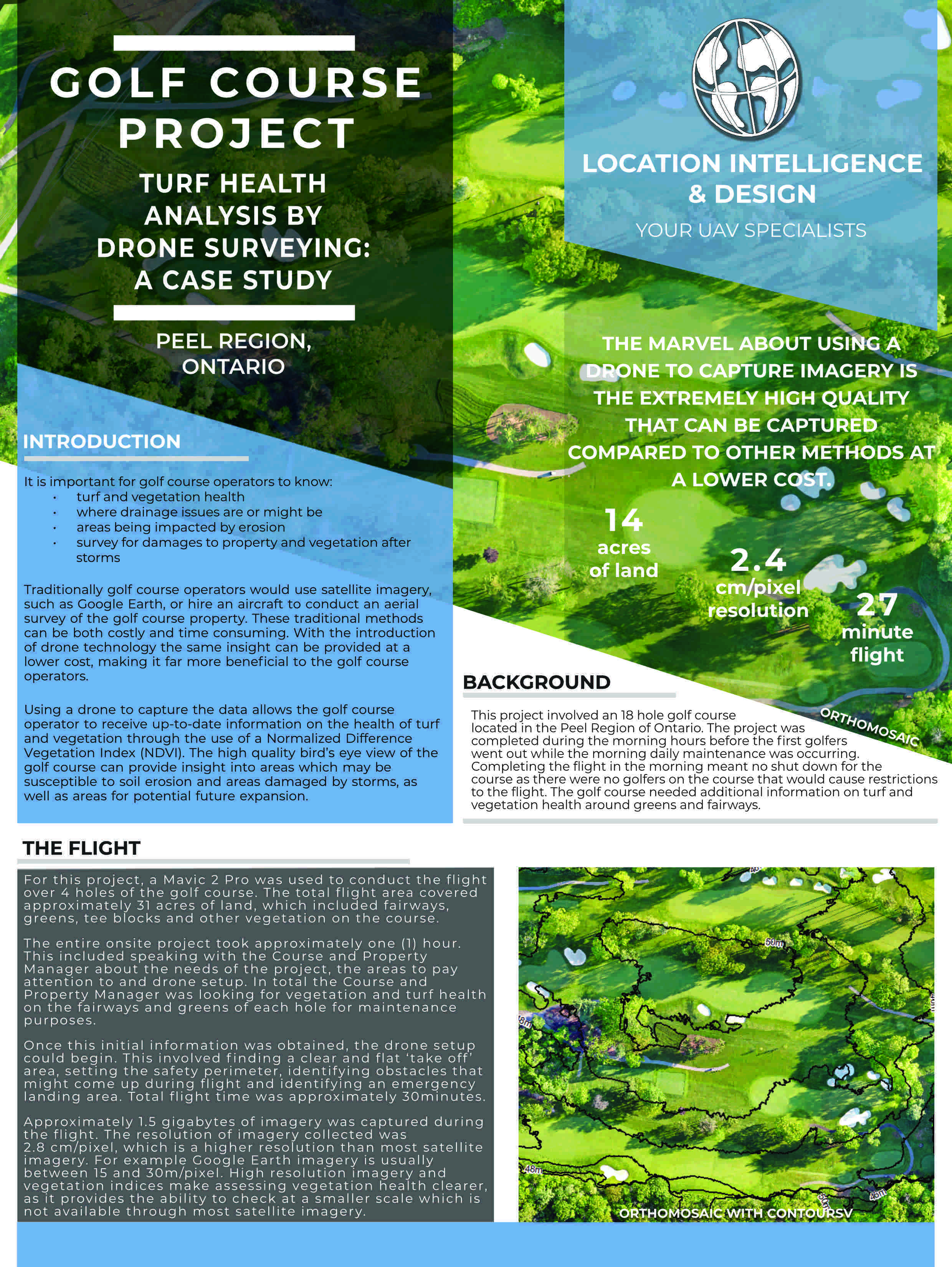
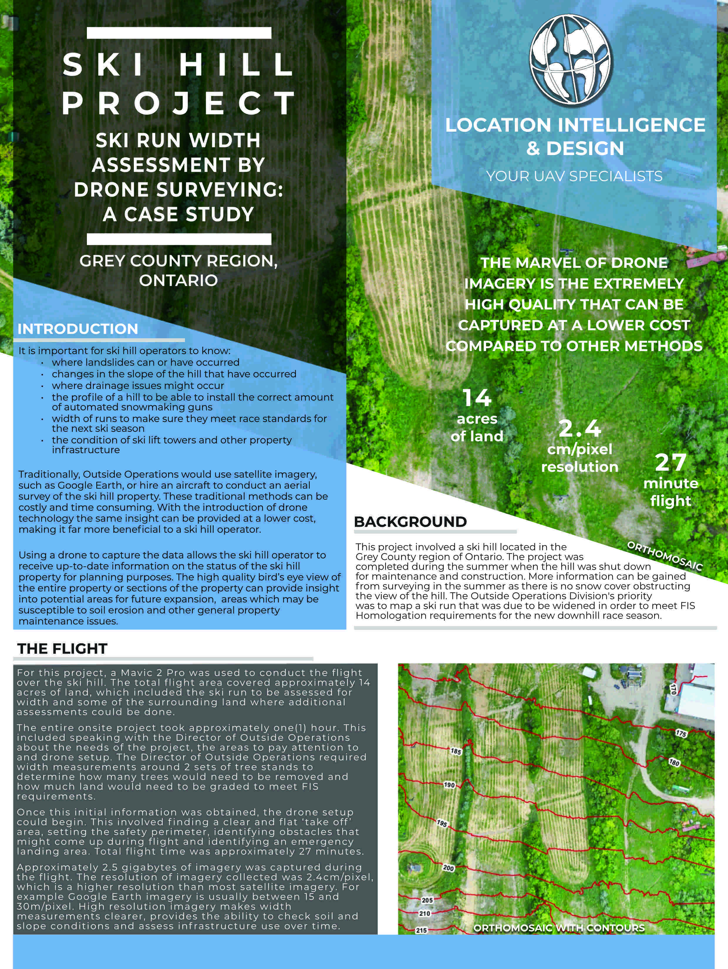
The Orthomosaic Photo
That high resolution image that stitches together hundreds or even thousands of flyover photos – provides a much higher resolution than what is available through Google Earth or other alternatives. Obviously, it can be an excellent source for construction of an archeological site grid-layout that is so fundamental to the archeological process.
●
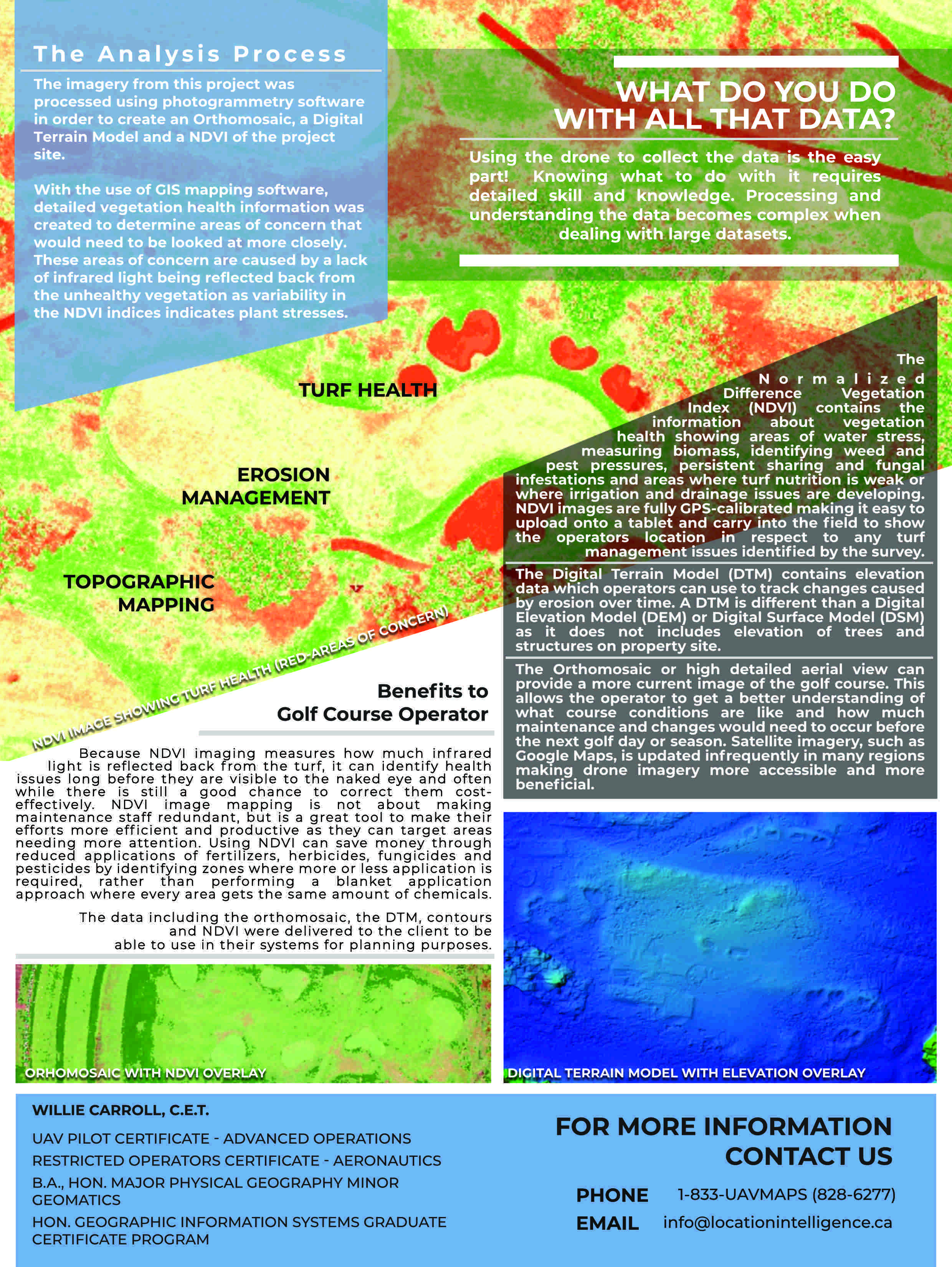
Detailed Elevation Data
The highly detailed elevation information captured during the drone photogrammetry process can be used to identify unique archeological details.
●
Multiple Uses
A drone can be used throughout a project. For example, a daily flyover of a dig site can be used to create extremely detailed elevation and grid information that can be used at any time in the future to analyze what was discovered. Drones bring greater clarity to the interpretation process of an archeological dig.
●
Accelerated Tools
The interpretation process can be accelerated with tools that go beyond the human eye – there is a lot of research going in to how to use new AI tools to analyze soil and material composition to potentially identify artifacts that might otherwise be unseen.
●
Planning
A drone can be an invaluable planning tool, providing information that can be used to identify areas for closer inspection.
●
Research Documentation
A source of information for later research documentation – by linking the exact location of discovered artifacts to detailed discovery databases.
●
3D
The 3D aspect of the data collected by drones can actually be helpful in reconstruction! For example, we can estimate how much material might exist within a particular archeological find, and then use that estimate for reconstruction of an ancient structure – information that was not previously easily available!
●
Public Relations
The public role of the information collected – it can be extremely useful for an eventual museum to display high resolution video and mapping material created during the field work process.
●
What’s Next
The data collected is an extremely powerful tool for future dig planning – the level of detail in an initial survey can then be used for creation of a plan for more in-depth research
●
Specialized Drone Payloads
Specialized drone cameras – near infra-red, thermal and other types – can enhance the information that is collected. Buried structures often carry a different thermal index – and drones can see what might not otherwise be seen!
Drones truly are providing for a disruptive revolution in the world of archaeology: as the Smithsonian article notes:
In 2016, drone imagery helped uncover an unknown massive monument in the ancient city of Petra in southern Jordan, and just last year, drone photographers found the remnants of 4,500-year-old henges, or monumental circles, in agriculture fields in Ireland’s Boyne Valley and previously unseen geoglyphs near the Nazca Lines in Peru.
At LI&D, our extensive background with drone, combined with our professional GIS digital mapping skills, provide you with the skills necessary for a small or large sized project.
Comments are closed.