Who
Use Case Examples
- Site surveys and site assessments
- Collection of data for PR management
- Environmental planning and assessment
- Safety and hazard risk assessment
- Detailed digital mapping information for ArcGIS and other onsite mapping tools
- Assess utility and infrastructure damage
- Before/after maps of impacted areas
- Developing a disaster response strategy
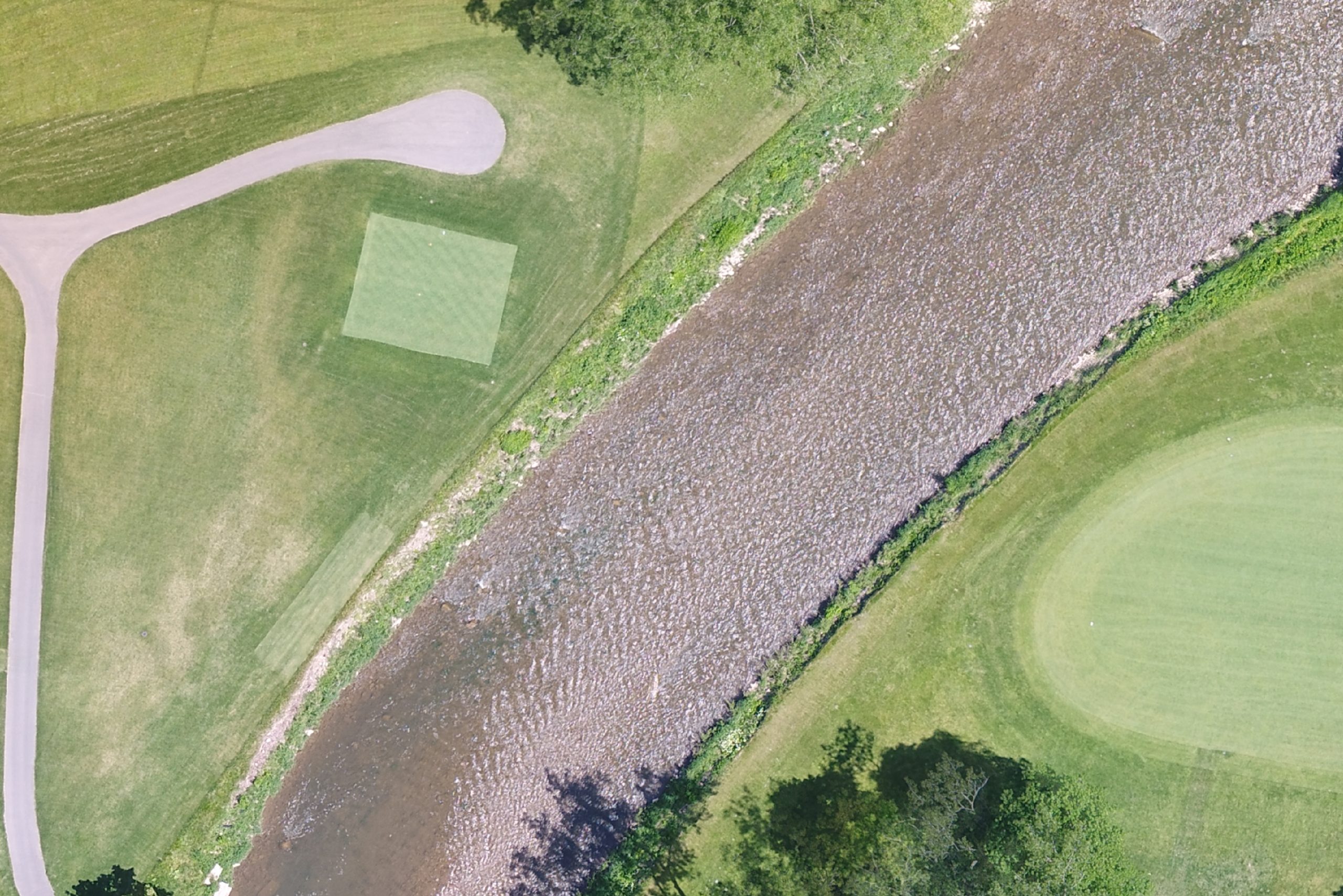
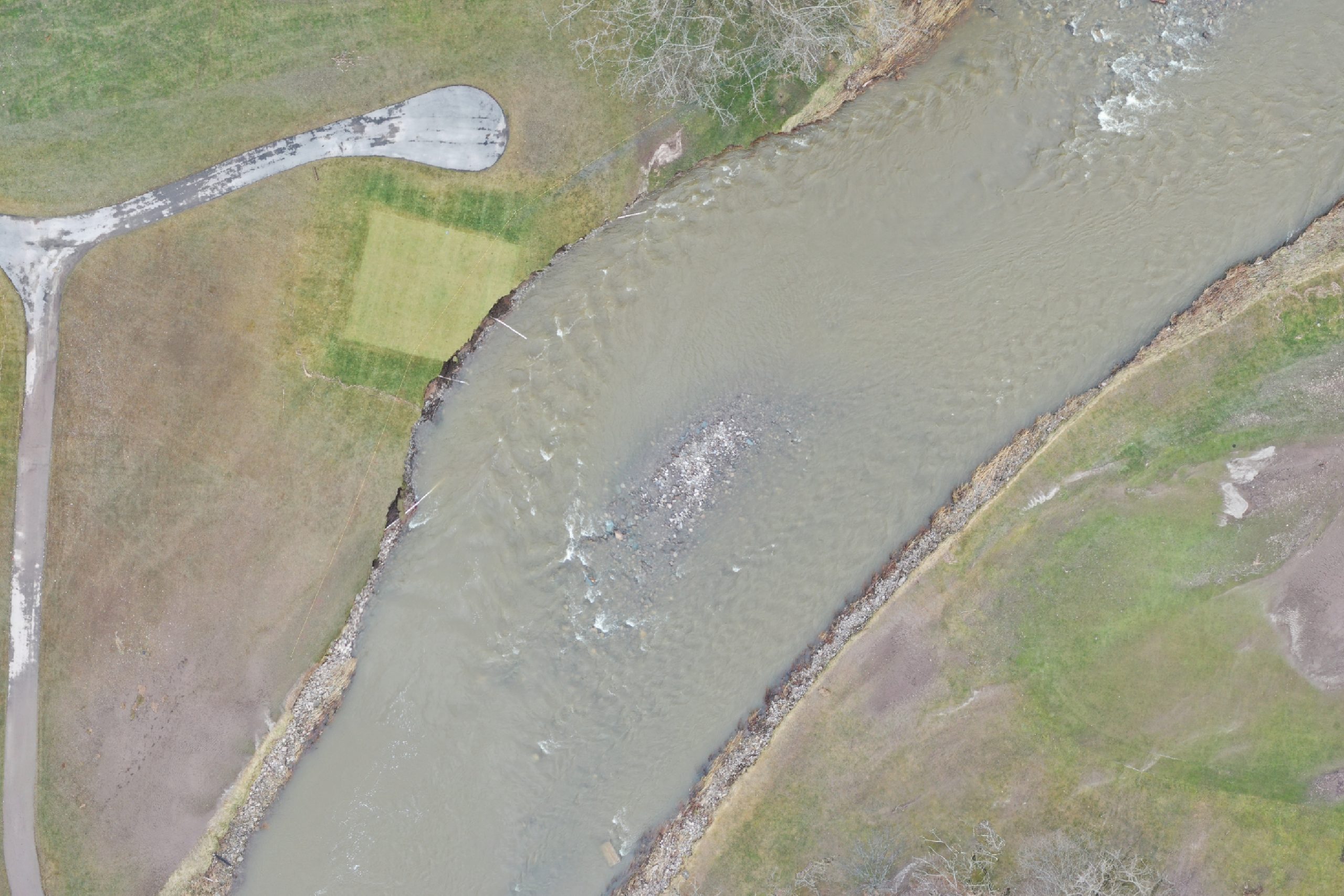
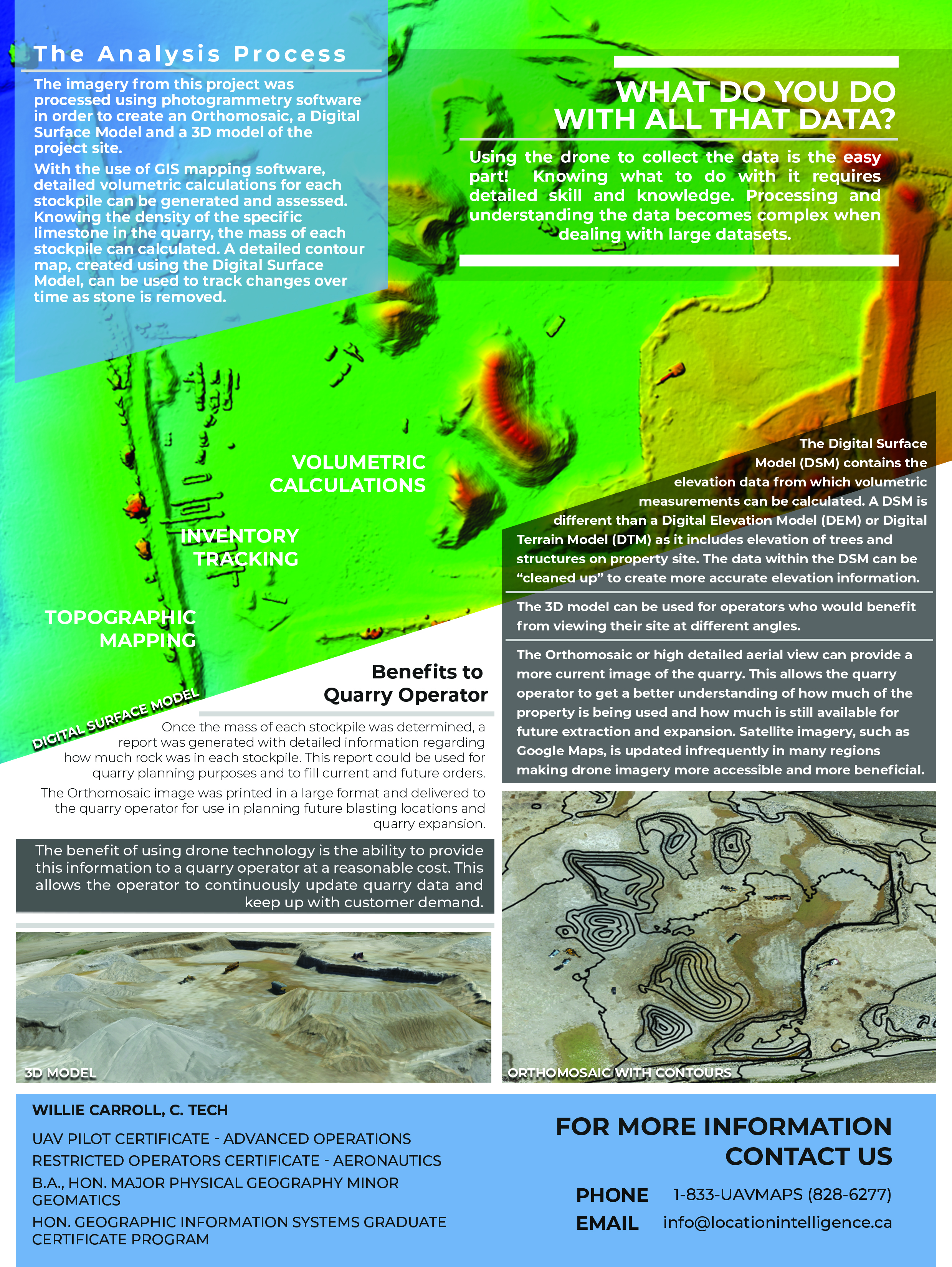
Shoreline Erosion due to Flooding
What to Consider
- Safety and risk minimization – reduction in need for ‘working at height’ of utility staff
- Speed of inspection and setup
- Capability to quickly reach harder to reach areas
- Ongoing record for potential lawsuit and legal risk minimization