That’s One Big Picture – But One With a Lot of Insight! Understanding the Magic that Comes from Drones, Photography and GPS Insight
Many of the companies who contact us with respect to our services aren’t quite sure exactly how we might be able to help them. As with the arrival of any type of new technology, some people are only just beginning to discover the future!
In some ways, the arrival of drone technology is a lot like the early days of the emergence of e-mail: people know that it is out there, but aren’t quite sure what they can do with it. Years later, it has become indispensible to every single aspect of their business operations.
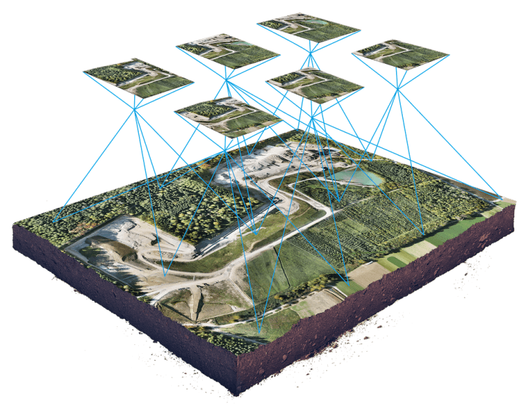
So with that in mind, we found one particular picture over at Wingtra – a manufacturer of very high-end sophisticated drone technology – that captures the essence of one of our services in a nutshell.
In essence, when we fly, we gather a lot of detailed photos. These photos are then processed and “unlocked” to gather some very powerful insight. The technical description: detailed GPS analysis based on extremely high quality ‘orthomosaic photography.’
That’s a mouthful, but let’s put it this way: in addition to general photography and video, it’s the analysis that counts. That’s what we excel at in LI&D.
In essence, when we are engaged to prepare an analysis for a client, we can turn the very detailed photographs that are collected into powerful information and insight that has not been traditionally available – or only available at an excessive cost.
How does this work? A recent flight over a golf course for a client – after some flooding damage – involved gathering 877 extremely high resolution images. Then, using some fairly sophisticated software, we were able to blend them into one large photograph – the ‘orthomosaic image’ – that could then be used for a comparison of before and after photos of the entire river bank. This is extremely useful for assessing the extent of flood damage, soil loss and other factors
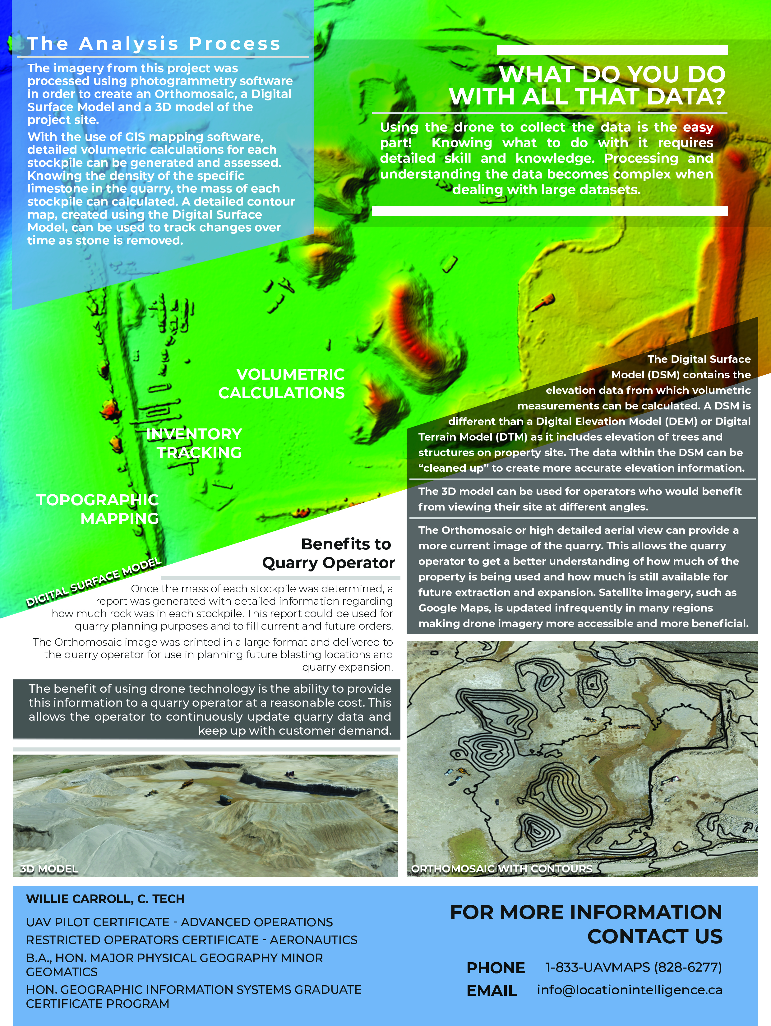
We do the same thing when doing a flyover of a quarry or mining site : hundreds of photos are combined into one large orthomosaic which can then used for volumetric calculations : i.e. we can advise the mine operator as the exact tonnage of particular stockpiles on site.
Why is this possible? Because the secret to higher end drone technology – i.e. not the ones your kids are flying – is the fact that each and every detailed image contains very detailed GPS technology – latitude, longitude and elevation. In this way, the ‘stitched’ image contains invaluable information of a 3D or ‘spatial’ nature, that can be sued for a variety of purposes.
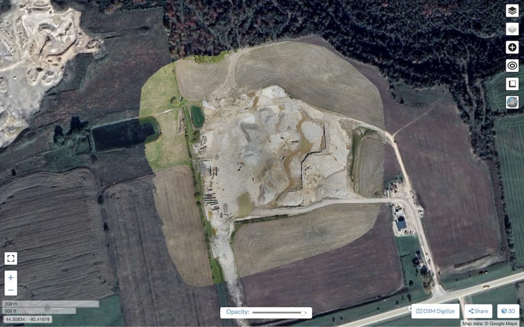
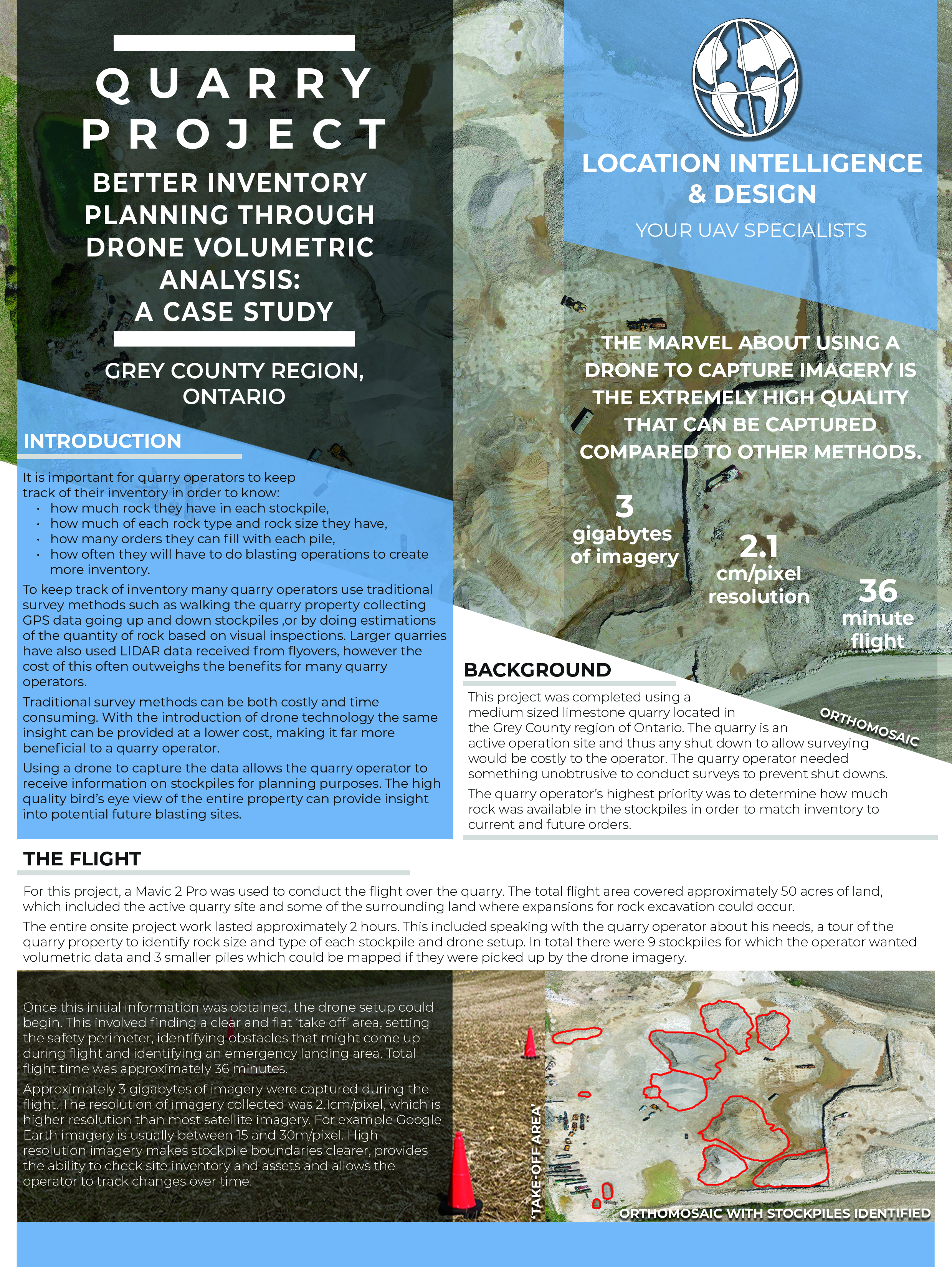
Here’s a really good example: if you take a look at our Quarry case study, you’ll get a bit of insight into the services we offer in that industry. To start, our flyover results in a very detailed map that combines all the photos together – in this case 277 photos totalling 3 Gb in size.
That is stitched into one large photograph – visually, it looks like this:
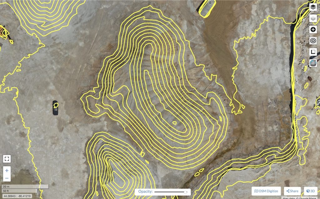
But that very detailed photo also includes a LOT of hidden data – such as this very detailed contour map that includes the elevation data embedded in those 277 photos.
That’s just a starting point – our project goes further. At the end of the project, we were able to provide this quarry operator with detailed inventory tonnage information – all gathered through our drone flyover!
As they say, you can learn something new every day. So if you aren’t quite sure of how a drone might help you in your particular industry, give us a call.
We’d be pleased to give you a quick overview, understanding and assessment!
Comments are closed.