What Is ‘Location Intelligence?’ And Why ‘Design?’
Someone asked the other day – ‘how did your company name come about? What exactly is ‘location intelligence,’ and why do you have the ‘design’ word at the end?‘
We spent a moment explaining – and thought this would make for a great blog post today!
So let’s break it into two key parts!
“Location intelligence?” Wikipedia defines it as
“the process of deriving meaningful insight from geospatial data relationships to solve a particular problem. It involves layering multiple data sets spatially and/or chronologically, for easy reference on a map, and its applications span industries, categories and organizations.”
It also goes by the name ‘spatial intelligence.’
Whatever – the description is a mouthful! What does it really mean?
The easiest way to think about it is that it is a combination of mapping and visual information on steroids! Satellite imagery with analysis! Overhead photos with detailed GPS information that helps to analyze particular patterns of information. Mapping insight that was previously unavailable, presented in a visually compelling way.
That is, it’s ‘location intelligence’ with ‘design.’
The concept has been around for quite some time – yet it is only with the arrival of higher end drone technology that the opporutnity has become available on a widespread basis.
The magic here at LI&D is that we combine both these elements to provide our clients with unique insight presented in a very accessible manner.
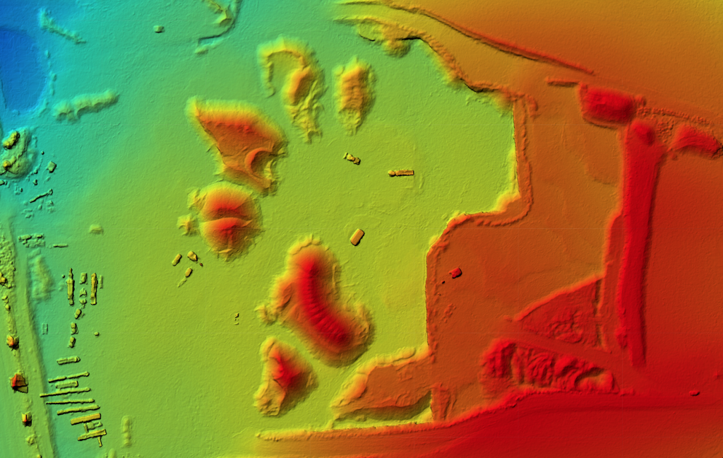
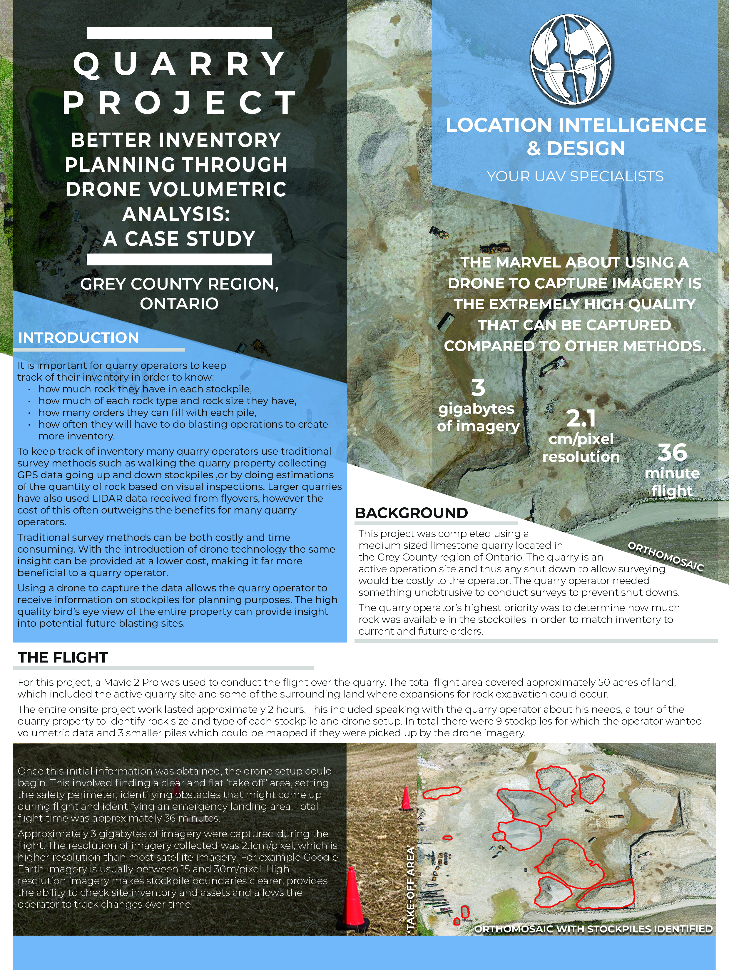
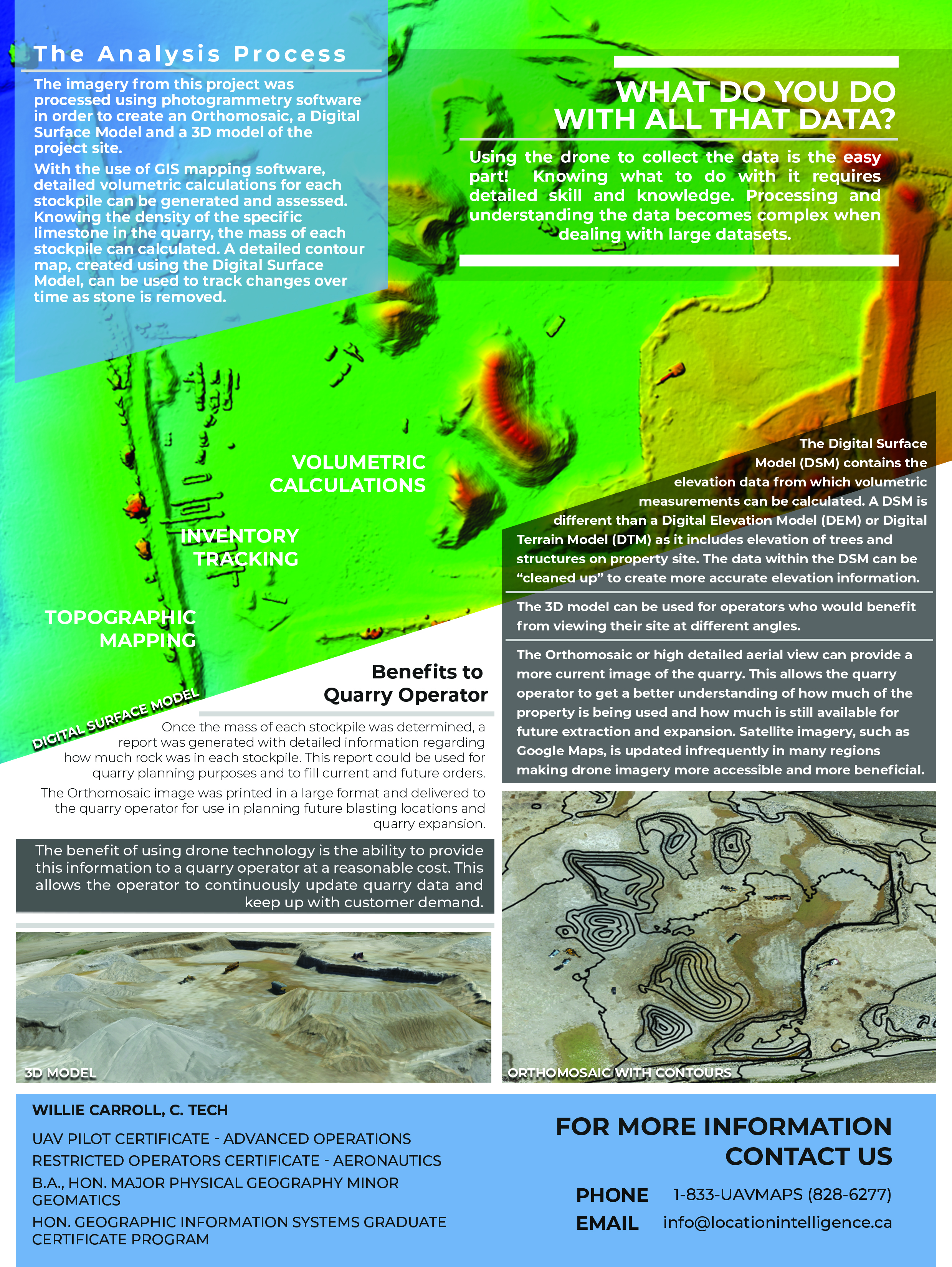
Consider the ‘orthomosaic’ and ‘surface’ model images obtained by a flyover of a quarry.
While they certainly look pretty, they also contain some powerful insight – in this case, we’ve got so much information from our ‘location intelligence’ that we can actually calculate, with a high degree of accuracy, for the quarry owner as to the actual tonnage of rock within particular piles.
The images are generated from very specific intelligence, or insight, into very detailed location (or GPS) information. Using our visual, GPS and digital mapping skills and creative capabilities, we then turn it into a powerful ‘design’ image that allows our client to see what they could not previously easily see!
And so there you have it! Location Intelligence & Design!
This is information that was previously unattainable – or only achievable at a prohibitive cost.
Comments are closed.